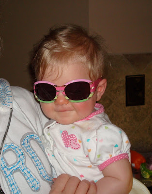
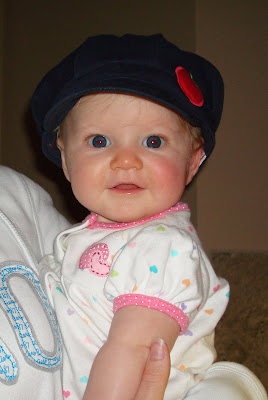
Oct. 3, 2008Jason and I really needed a vacation!! We hadn't gotten away since before we had Ella and we really wanted to do some things that we knew Ella could not do with us. So we figured this was the best time since seperation anxiety really hasn't begun yet and Nonnie was excited to keep her!! We wanted to get outside and enjoy the beautiful weather were having!! We decided at the last minute to take a trip to Gatlinburg. I purchased a hotel room on hotwire for a fantastic rate, we packed up, took Ella to Nonnie's house, and took McKenzie to work with us, so when we left at lunch we could drop her off to be boarded. I hated to do it since she had just had a long stay at the vet, but they really love her there and she is treated well! We arrived at our Hotel around 7:00pm, checked in to a suprisingly nice room, and headed out to The Alamo Steakhouse for dinner (at traffice light 2A - just average food). Then we headed back to our room to get into bed early. We had big plans for the next day and we needed our rest.
Oct. 4, 2008 We woke up around 6:00am (sunrise is at 7:30). Flapjacks pancake house didn't open until 6:30. We were the 2nd ones to arrive. After a quick breakfast we headed out to find the Roaring Fork driving trail. By the way, there are no signs, turn at the space needle (light #8) and just go straight (thanks mom) and you'll come out at light #3 - I think. Anyway - it was very quiet out. No wildlife, I thought for sure this was the beginning of an uneventful trip.
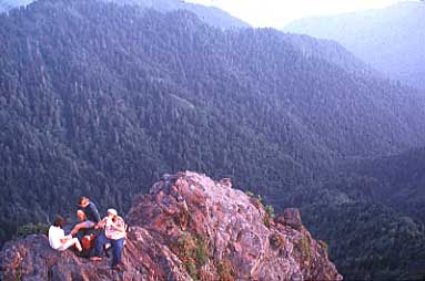
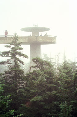
Here we are at Roaring Fork Bridge in 2005.
Roaring Fork Motor Nature Trail A five-mile one-way tour that is referred to as a "motorized nature trail". From the main parkway (Hwy 441) in downtown Gatlinburg, turn at stoplight #8 onto Airport Road. At the intersection, continue straight on. You should stop at the historic Bud Ogle Farm to get an idea of life on a mountain farm. You'll also have the opportunity at stop #5 of the self-guided tour to hike 1.2 miles to Grotto Falls. When the water is up in the spring, Roaring Fork Creek, which parallels the road much of the way, is a sight to behold. Other features include a waterfall named "Place of a Thousand Drips". No trucks, RVs or trailers are allowed because the road is very narrow. In fact, in some places, trees encroach right to the edge of the road. The markings on the trees are clear evidence why anything larger than a car is ill advised. The motor trail makes a loop and ends in Gatlinburg. At the stop light, turn left on Hwy 321 and return to the Parkway. The road is closed in winter. Expect to spend about two hours on this tour (three if you hike to grotto Falls), depending on what features you stop to explore. http://www.gatlinburg-tennessee.org/roaring_fork.htm
After we left Roaring Fork, we headed to the sugarlands visitor center (which opened at 7:00am) to get some trail maps for day hikes. We decided to hike Chimney tops first, we were told by a ranger that this was considered one of the most strenuous hikes in the park. We decided to go anyway. It was tough! 2 Miles uphill, over rocks and roots. It was like climbing 2 miles of uneven stairs. It was totally worth it though. When we got to the top, it was pretty narrow. Jason was nervous about us orphaning Ella. It definately wasn't a easy decision. But there were some other hikers there that had climbed it before and they gave us the confidence to climb up.
Geology Chimney Tops is one of the few instances of a bare rock summit in the Smokies.[1] Over the centuries, the bedrock atop the mountain has been exposed through natural weathering of the upper layers of soil strata. This rock is mostly Anakeesta Formation metamorphic rock, especially slate, phyllite, and metasiltsone.[2] The grainy, contorted capstones offer excellent footholds and handholds for climbing. Like most of the Appalachian Mountains, Chimney Tops was formed 200 million years ago when the North American and African plates collided during the Appalachian orogeny.
When we left there we decided to drive to Cherokee, N.C. to see what all the fuss was about. I know I had been there before but I didn't remember anything about it. It was pretty boring and we had the most horrible meal for $20 I have ever had! The whole place was pretty sketchy. Unless you want to find the casino or just drive the Cherohala Skyway and watch the whitewater rafters, float down the Occoee, just stay in the national park. We came back and on the way we stopped at Clingman's Dome, the highest point in the Smokies, and in Tennessee, and the second highest east of the Mississippi. I thought my legs had recovered enough to climb the paved trail to the top. I was still tough. When we left there we drove to the top of Ski Mountain to go to Ober Gatlinburg. Jason had never ridden the lifts or the Alpine slide. It was fun but we couldn't race because a whole section from one slide was missing. It should be illegal to charge what they charge for that place. We ended up just buying a bracelet that let you do everything as many times as you want for $18 a piece!! The only time we rode the ski lifts all the way to the top, a momma bear and three cubs crossed the alpine slide. WOW! Some people never see that in 10 years of trips to the smokies!! WE MISSED IT!! I thought my trip was ruined!! To be right there and miss it! I wanted to cry! All of the Employees were scrambling up towers trying to see where the bears went. They closed down the slide. Finally, they set off some fire crackers in the woods just to make sure they were gone before reopening the slide. We left there when we had done all that we could do. Suprisingly, the most fun we had there was on a water slide (in a raft)! We went back to the hotel, quickly changed clothes. We were exhausted but we still had to eat. Our hotel was beside the Ripley's Aquarium at traffic light #5. We walked from there, past the space needle at traffic #8 a few more blocks until we came to a resturant on the left called Calhouns. It said out front "Best Ribs in the South!" Well, I don't know if they were the best, I was starving, but they were really good. Everything we ate there was good. Kemps Ribs in Tuscaloosa are the best in the south by the way.
Clingmans Dome At 6,643 feet, Clingmans Dome is Great Smoky Mountains National Park's highest point. It is the highest point in Tennessee, and the second highest point east of the Mississippi. Only North Carolina's Mt. Mitchell (6,684 feet) rises higher. Clingmans Dome is a popular Park destination. Located along the state-line ridge, it is half in North Carolina and half in Tennessee. The peak is accessible after driving Clingmans Dome Road from Newfound Gap, and then walking a steep half-mile trail. A paved trail leads to a 54-foot observation tower. The Appalachian Trail crosses Clingmans Dome, marking the highest point along its 2,144 mile journey. Vistas from Clingmans Dome are spectacular. On clear, pollution-free days, views expand over 100 miles and into seven states. However, air pollution limits average viewing distances to 22 miles. Despite this handicap, breathtaking scenes delight those ascending the tower. It is a great place for sunrises and sunsets. Cloudy days, precipitation, and cold temperatures reveal the hostile environment atop Clingmans Dome. Proper preparation is essential for a good visit. Weather conditions atop Clingmans Dome change quickly. Snow can fall from anytime between September and May. Get a current weather forecast before heading to the tower. The cool, wet conditions on Clingmans Dome's summit make it a coniferous rainforest. Unfortunately, pests, disease, and environmental degradation threaten the unique and fragile spruce-fir forest. Dead trunks litter the area, and dying trees struggle to survive another year. Berries thrive in the open areas, and a young forest will replace the dying trees.
Oct. 5, 2008 We woke up agian at 6:00 am, had breakfast, but this time we drove out to Cade's Cove. We were still hoping to catch a glimpse of a bear. I didn't realize that it would take nearly an hour to get there, so by the time we arrived the sun had risen. It was nearly 8:00am when we were approaching the gates. Right outside the gates there was a large black bear eating white acorns along the side of the road. I'm not sure whether it was a boy or a girl bear, but it seemed like a nice bear. I was so excited!! Our trip had been saved!!!! WOW!! He came within 6 ft of our car. I really need to get a new camera or Jason was really shaking - beacuse none of the pictures are very good.
After we left Cades Cove we wanted to go Horseback riding, but not just on a flat trail, we wanted to mountainous view ride. We decided on Sugarlands riding stable. Jason and I chose the hour and a half ride. No one else chose that ride so it was just Jason and I with our guide, Gary. They told us that they never let the horses go faster than a walk but Gary told us once we started that we could get them into a trot if we wanted to. Jason was in the back. He was riding a horse named "Chance." He kept letting Chance fall behind so that he could "catch up" by racing up behind us. When we started up the mountain side, my horse, "Poppy", which I believe was indicitive of his age - not a flower, stumbled and fell onto all four shins while I was riding him. Fortunately, I didn't freak out. Gary said that I did the right thing by staying on him. Jason, however, did freak out! Everything was ok after that though. Poppy even got up to a trot a few times. It was a lot of fun. We didn't see any wildlife but just riding was fun. Jason lost his extra shirt and sunglasses playing with Chance. We recovered his shirt the next day. His Oakley's, however, are probably on someone else's head right now. We were a little sore but nothing like from hiking!!
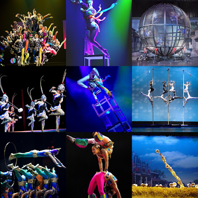
After riding horses we really stank! So we went back to the hotel and took showers. We decided we would spend the afternoon in Pigeon Forge. We ate lunch at the Apple Barn (best food in Tennessee), went to the Tanger outlets and got Ella some great summer clothes for next year, and saw a show - Cirque de Chine (chinese acrobactics). It was great!
Oct. 6, 2008We decided to sleep in so there would be a little relaxing going on during this vacation. When we got everything packed up to leave, we checked out of our room and headed back to the outlets. But not before we stopped at a Homemade Candy shop to get some goodies - its tradition! At the outlets we found Jason and I some fall clothes and we headed for home. Finally! I hated to leave - but I missed my baby!! I know she was being well taken care of, but I don't think I will be able to take another trip without her! WE LOVE YOU GRACIE!!